On Wednesday, February 13, Mt. Shasta received several feet of snow followed by rapid warming. Sometime in the afternoon / evening of February 13-14, this natural storm-slab avalanche cut loose in Avalanche Gulch on Mt. Shasta. The start zone was likely someplace above Lake Helen on Casaval or Sargent’s Ridge between 11,000 and 12,000 feet. The avalanche dropped around 4,000 feet in elevation and ran over three miles before stopping about ½ mile from the road at Bunny Flat. While we can’t say it is the largest one ever, we can say it is the one of the largest avalanches any of us have ever seen here. This is an avalanche of historic proportions
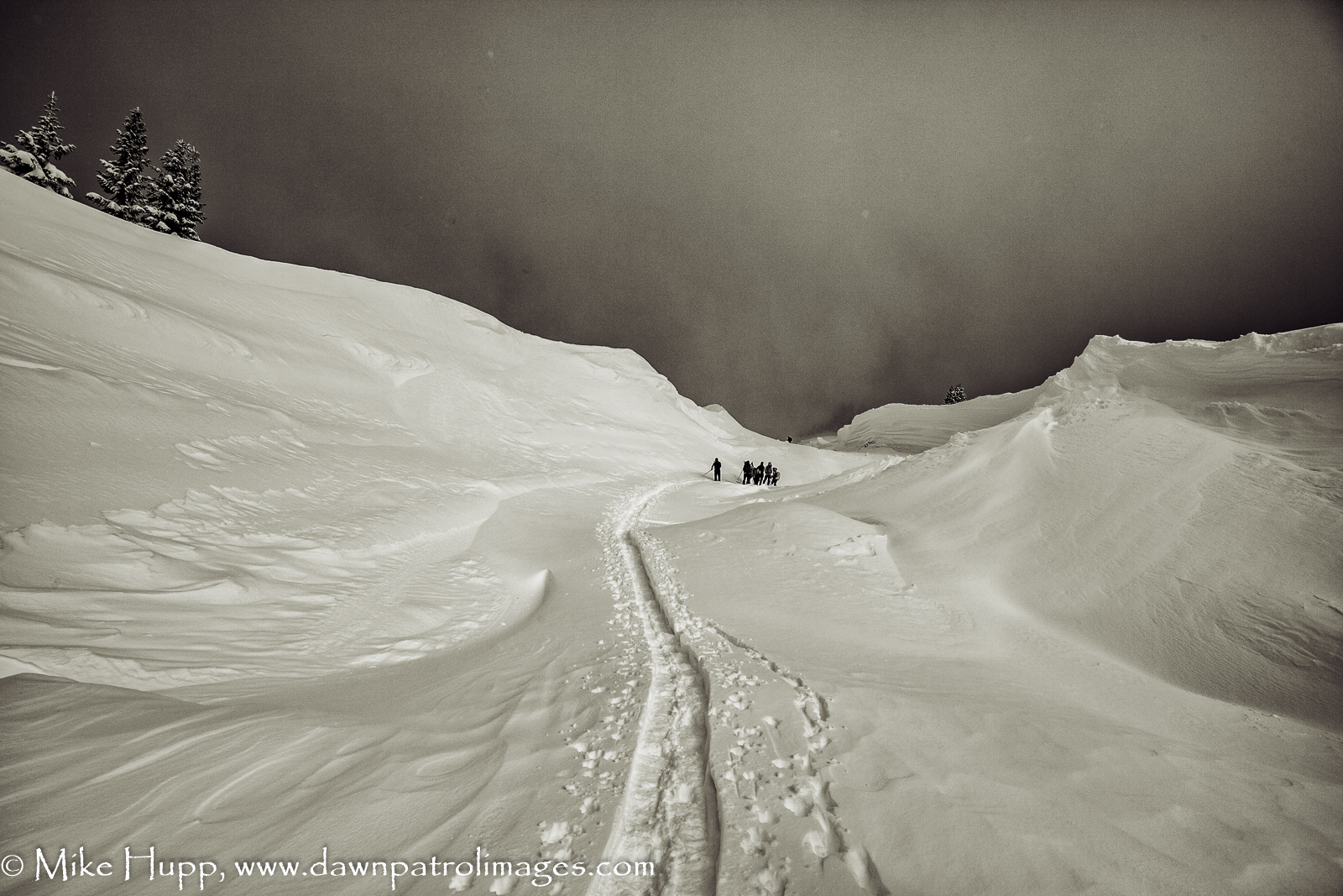
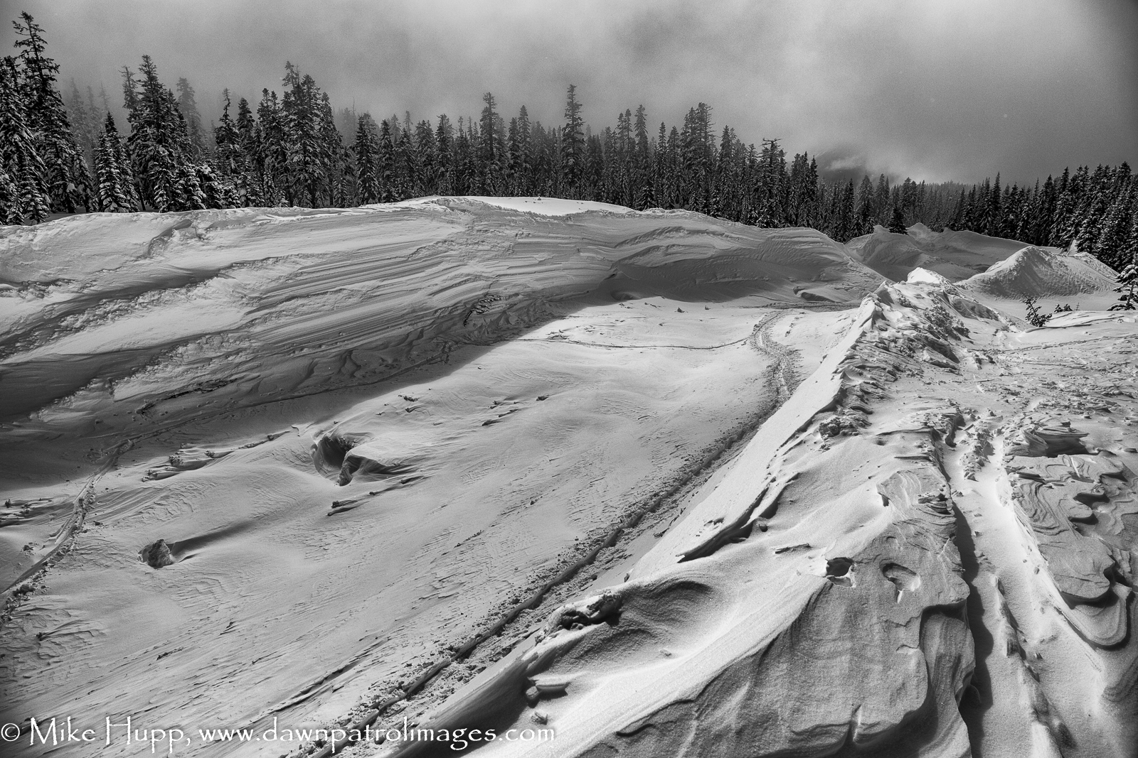
This is what you see when you come to the back side of the terminus. The red line marks the debris pile. Estimates put it at 20-30 feet deep and 600 feet long. A panorama from the tip of the terminal debris pile. Looking up Avalanche Gulch from the terminus of the slide. About 300 yards from the terminus, looking north in the runout zone. Note the skier in the center of the track for scale.Moving out into the center of Avalanche Gulch. Near the Gemini Tree about 1/4 mile from the debris field. The canyon wall of snow here is about 20 feet high. Crossing the track near the Gemini Tree. This is a bout 4,400 feet from the terminus and about 2 1/2 miles from the start point. Farther up the track, about 5,000 feet from the terminus and over 2 miles from the start zone. The gulley that the slide followed comes down turns right in the center of the photo.About 1.3 miles from the terminus and about 2 miles from the start point. The slide came down the gully beneath the cliff in the center of the photo. If you look closely, you can see the “bathtub ring” from the slide on the canyon walls.


Mike, these are absolutely incredible shots. Thank you for sharing.
LikeLike
Well, this was certainly one of the most gee whiz things I have ever seen. I am glad you like the photos.
LikeLike
incredible photos, thank you! My favorite place from childhood and now!
LikeLike
Really impressive. Nice shots. Just viewed the drone footage as well.
LikeLike
Very tasty! Magical to experience the raw power of nature the way you do..
LikeLike